Geospatial

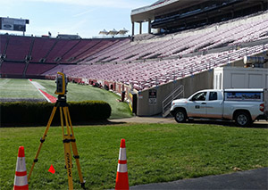
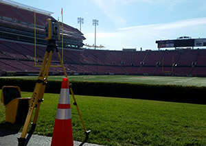
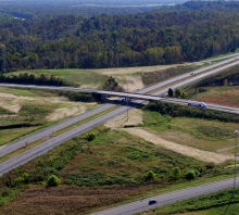
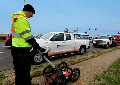
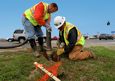
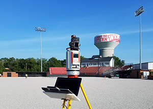
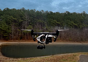
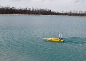
Every successful design project begins with accurate data collection.  In our rapidly accelerating, technologically driven world, the demand for faster, more accurate data collection which is usable immediately and real-time connectable from the field to the design offices is a necessity today.  Survey data collection has evolved well-beyond simple boundary and/or topographic conventional instrumentation and with these changes, so too has AEI.  Gone are the days of total stations, theodolites, transits and chains—today’s surveying, or data collection, includes LiDAR 3D Scanning, Underwater Sonar, Aerial UAV drones, and Electrical Resistivity equipment.  The spatial limitations of the past can now be overcome more easily and much more quickly thanks to these technological advancements.  While AEI will continue to “survey” using the technologies and methodologies of the past, we also have invested heavily in the next generation of data collection technologies and area-specific expertise.  We can provide a full menu of data collection capabilities, dictated by the needs of the project and our clients, all to support and enhance the use of Geographic Information Systems (GIS).  Our commitment to using the most advanced and contemporary geospatial tools adds professionalism, flexibilities and speed to all our surveying services.   Better tools.  Better Project.  AEI has them and now brings these tools under a division we call “Geospatial Services”

AEI...DESIGNING YOUR FUTURE


Capabilities

  • LiDAR (Terrestrial Based)
  • GPS surveying
  • Subsurface Utility Engineering (S.U.E ) (Level A thru D)
  • Ground Penetrating Radar (GPR)
  • Underwater Sonar Surveys & Inspections
  • Electrical Resistivity Analysis
  • Boundary & Easement Surveys
  • Topographic Surveys
  • ALTA/ACSM Land Title Surveys
  • Subdivision Platting
  • Construction Staking/Layout
  • Bathametric Surveys
  • Hydrographic Surveys
  • Aerial Mapping Coordination
  • Linear Network Mapping
  • Control Networks
  • Airport Geodetic Control Networks/Control Monumentation (PACS and SACS)
  • Building/Column Layout, Alignment and Control
  • As-Built Surveys
  • Right-of-Way Surveys
  • Route Surveys for Railroad, Water, Transportation and Utility Corridors
  • FEMA Flood Certifications
  • Volumetric Surveys
  • Underground (Cave and Quarry Surveys)
  • Pre- and Post- Condition Surveys
  • Horizontal and Vertical Settlement & Movement Monitoring
  • Airport Obstruction Surveys
  • FAA AGIS Surveys

Our Offices

  • Glasgow, KY

    65 Aberdeen Dr.
    Glasgow, KY 42141
    Tel: 270.651.7220
    Fax: 270.651.3246

  • Louisville, KY

    2500 Nelson Miller Parkway
    Louisville, KY 40223
    Tel: 502.245.3813
    Fax: 502.245.3814

  • Owensboro, KY

    308 E. 25th Street
    Owensboro, KY 42303
    Tel: 270.478.4610

  • Acworth, GA

    5160 Acworth Landing Drive
    Acworth, GA 30101
    Tel: 770.421.8422

  • Lexington, KY

    2456 Fortune Drive Suite 100
    Lexington, KY 40509
    Tel: 859.263.0009

Send Us a Message

Your Message Has been Sent

Thank you for your interest! We will get in touch as soon as possible!

Send Another Message